%20(1)%20(1).png)

Read more
Unmanned Aerial Platforms: A Critical Surveillance Tool in the Fight Against Wildfires
Version 1.0.0
January 2026
Published
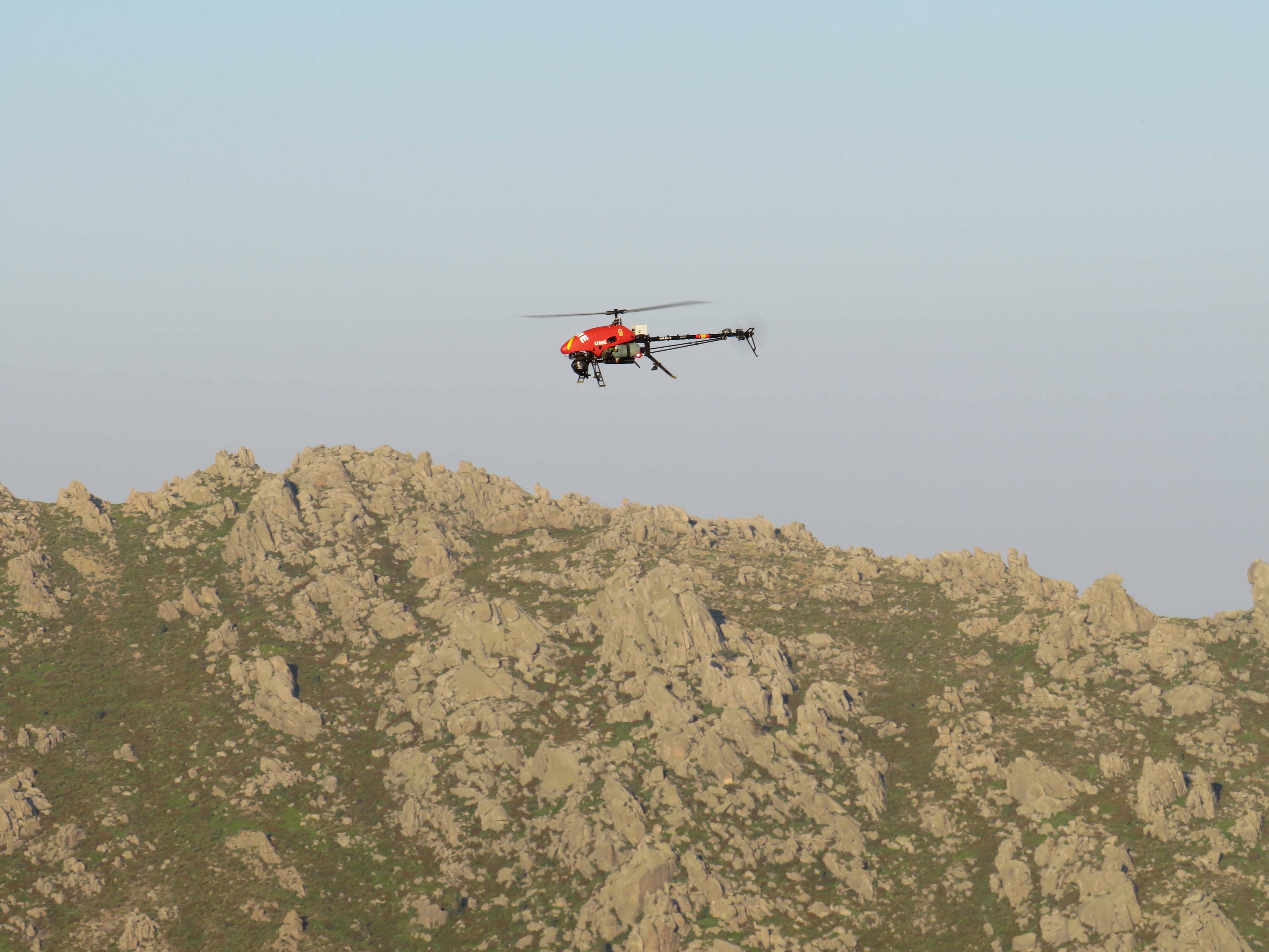
2026 is turning out to be a catastrophic year for wildfires. The impact is on a global scale. By August 2026, fires have burned over 112 million hectares of land worldwide, an area roughly the size of South Africa.
Australia logged 11.8 million hectares, including a January outbreak that destroyed over 300 structures and required thousands be evacuated. Canada endured its third consecutive extreme fire year, with roughly 70,000 people evacuated and an estimated $360 million in direct losses. Chile and Argentina saw January to February fires kill 23 people and displace 55,000 more across Patagonia.
In Spain, close to 194,000 hectares had burned by early August, nearly six times the pace of 2025. Spain and France together evacuated more than 320,000 people by late July. The United States, meanwhile, has recorded more than 29,000 wildfires burning roughly 950,000 hectares so far this year.
Different continents, different terrains, causes, and climates. The same failure point keeps showing up: by the time a fire is visible to the teams responding, it's often already too large to contain safely.

The Challenges Facing Wildfire First Responders
Fire response commanders and extinction crews are working against conditions that get harsher every season. Wherever the outbreak takes place, the challenges faced are consistent:
Limited visibility.
Dense smoke plumes obscure the fire front from both ground crews and low-flying manned aircraft, making it difficult to judge where flames are actually advancing versus where they've already passed.
Fast-changing fire behavior.
Wind shifts, spot fires, and fuel load variations can modify a fire's perimeter within minutes, faster than most manned reconnaissance teams can update command centers.
Risk to aircrews.
Manned helicopters and fixed-wing spotter planes often fly low and slow over active fire zones to gather intelligence, exactly the flight profile most exposed to smoke hazards, turbulence, and reduced visibility.
Locating people in the fire zone.
Residents who haven't evacuated, stranded hikers, or crews cut off by a shifting fire line are hard to spot through smoke. And at night, manned aerial assets are frequently grounded and manual search becomes even more dangerous.
Coordinating multiple assets.
Ground crews, air tankers, and command centers all need the same real-time picture. Data delays or gaps in “shared awareness” cost critical response time.
Resource allocation under uncertainty.
Without a reliable, continuously updated map of hotspots and fire spread, commanders are forced to commit crews and manned aircraft based on information that may already be out of sync and outdated.
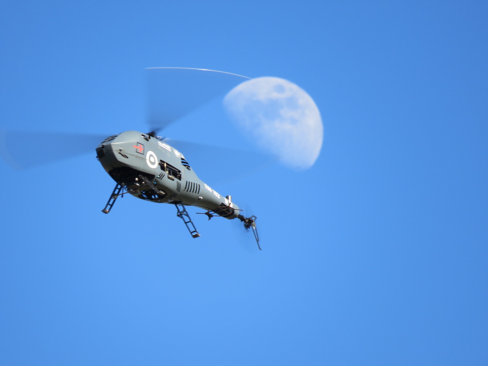
UAV Sensor Payloads That Enhance Wildfire Intelligence
Unmanned helicopter sensor payloads can add real operational value, giving commanders continuously updated, high-quality data without putting their personnel at risk.
Today’s thermal/infrared (IR) cameras can detect heat signatures through smoke and darkness, identifying active hotspots, smoldering areas, and flare-up risk zones that aren't visible to the naked eye. The same IR payloads used for hotspot mapping can pick out the heat signature of a person, whether a stranded resident or a crew member separated from their team, even through moderate smoke cover.
In addition, electro-optical (EO) cameras can provide high-resolution daylight imagery for damage assessment, perimeter mapping, and confirming containment lines.
The use of multispectral sensors can help distinguish active flame fronts from already-burned or unburned vegetation, for more accurate fire-spread modeling.
GPS-tagged live video and thermal feeds streamed directly to incident command let multiple agencies work from one synchronized picture instead of separate reports.
Heavy-fuel powered UAV helicopters can act as powerful force multipliers in the fight to contain forest fires. With a much longer endurance than battery-powered drones, greater payload capacity for better thermal imaging, and hours of loiter time over fire fronts, these platforms can effectively capture and transmit real-time hotspot data, without putting a single pilot inside the smoke plume.
Manned crews still have a crucial role to play in fighting the fire. Unmanned aerial systems can provide critical support to manned crews, helping to prioritize suppression and rescue efforts.

What the ALPHA A800 and A900 Bring to Wildfire Response
The ALPHA 800 and ALPHA 900 are built for exactly the operating conditions wildfires create, and can play a critical role across the full lifecycle of a wildfire outbreak.
Persistence, day or night.
Fuel-powered propulsion gives Alpha unmanned helicopters significantly longer flight endurance. High quality thermal payloads mean that persistence doesn't stop when the sun goes down or when smoke and low light degrade visibility. Fires don't pause overnight, and real time fire intelligence must not pause either.
Fast, low-footprint deployment.
Both platforms take off and land vertically from small, sites, including moving vehicles, without the runway, ground crew, or logistics a manned aircraft requires. In a fast-moving fire, “eyes in the sky” can be deployed in 20-25 minutes and transmit critical intelligence.
Lower risk to aircrews and first responders.
Every hour the A800 or A900 spends over an active fire front is an hour a pilot doesn't have to fly through smoke, turbulence, and dangerous visibility to get the same surveillance picture.
Lower cost than manned assets.
Fuel-powered helicopter UAVs cost a fraction of manned aircraft to operate per flight hour, letting agencies keep assets in the air longer and across multiple fronts without the same strain on already limited resources.
Integration with centralized command and manned assets.
Live video, thermal imagery, and telemetry stream directly into existing incident command systems and can be shared with pilots of other aerial assets, giving everyone working a fire the same synchronized, real-time picture.
Imaging for full damage assessment.
Multispectral and thermal sensors don't just find active flame fronts; they map the complete extent of a burn once it's out, distinguishing scorched from unburned vegetation and giving authorities an accurate damage assessment from the air rather than slower, resource-intensive ground surveys.
Supporting recovery, not just response.
The same aerial surveillance capability extends beyond fire containment. Post-fire flights can guide clean-up crews to the areas most in need, track vegetation regrowth to inform reforestation planning, and even support the aerial seeding of burned areas, turning a platform built for emergency response into a tool for long-term recovery.
Wildfire response has always needed more eyes in the sky. The ALPHA A800 and A900 are designed specifically for this, from the first hour of an incident through the years of recovery that follow.
.jpg)

.svg)


.png)
